Driving Directions
to the Connecticut Monument at Grant's Canal
Vicksburg National Military Park

Coming from the Military Park in Vicksburg, Mississippi, take Rte. 61 S, (South Washington Street), towards I-20
Turn Left to merge onto I-20 W... Entering Louisiana
Take Exit 186 and merge onto US-80 W
You will cross a set of railroad tracks. Turn right onto LA-3218 E, which is immediately after the tracks. Go towards Delta.
Before you get to Delta, there is a road to the right with a small sign pointing to Grant's Canal. (In 2008, this was a small dirt road connecting LA-3218 & Grant's Canal Road. Turn right onto this road.) If you get to Delta, you've gone too far.
At the end of the dirt road, turn right onto Grant's Canal Road
Drive under the bridge for I-20
Grant's Canal is on the left shortly after the bridge.
-
The monument is set back from the road. After you park, you will find National Park Service plaques with the history of the Grant's Canal site and a sidewalk leading to the monument.
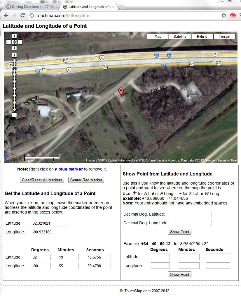
If you would like to use latitude & longitude coordinates, here is a screen shot that might help too... Latitude: 32.321021, Longitude: -90.933189
In 2008, Google Maps had a typo: they had Grants Canal Road labeled as Grants Ganal Rd, which led to some confusion in generating maps to the monument site. You will note that typo if you look carefully at the links below: (The directions remain the same though.)
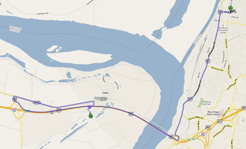
Clicking on the picture will open a new window with a larger view of this screenshot (which includes directions from Vicksburg) in pdf format.
The satellite maps still don't show our monument but here you can clearly see the small dirt road connecting LA-3218 and Grant's Canal road.
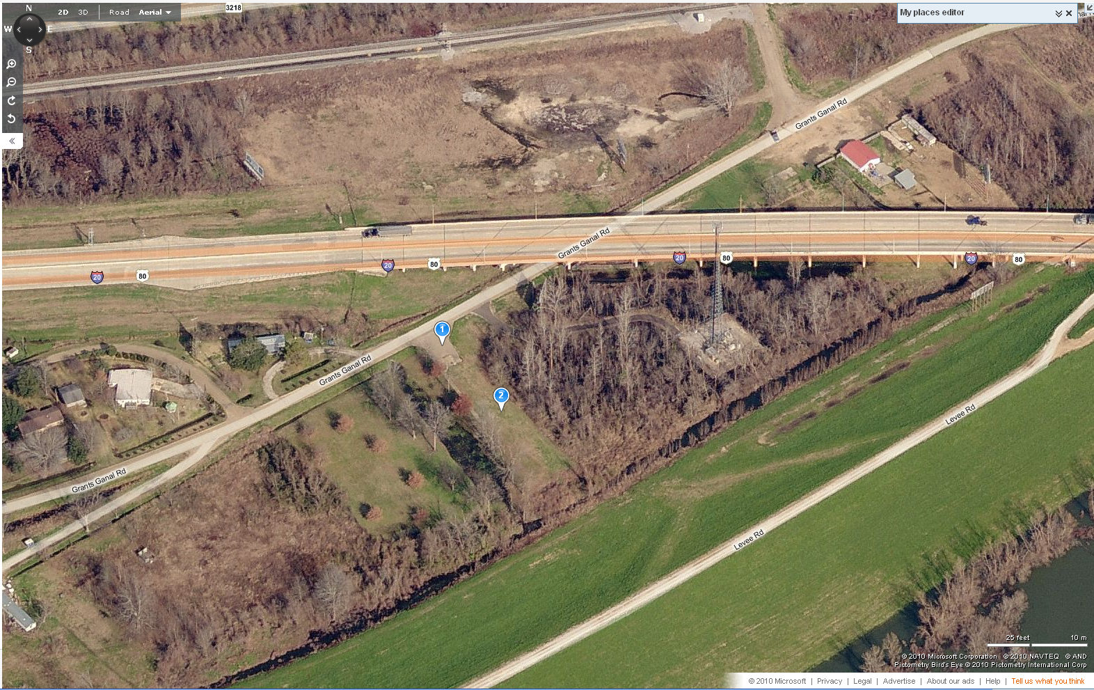
Clicking on the picture will open a larger view of this screenshot in a new window
Marker 1 shows the location of the parking area
Marker 2 shows the approximate location of the Connecticut Monument
The remnants of the canal are flooded in this picture, and look like a dark streak just to the left of the markers. If you look closely, you will see a sidewalk next to the canal.
Since the satellite maps still don't show our monument, here's an aerial photograph taken in 2009 by the Army Corps of Engineers. Here you can clearly see the Connecticut Monument at the Grant's Canal site of Vicksburg National Military Park.
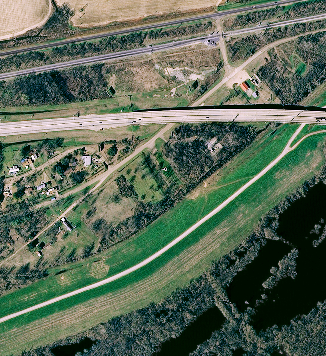
Clicking on the picture will open a larger & more saturated view of this image in a new window